
Airppb
Air pollution can change sharply across a neighborhood, and a single ground monitor may miss those local differences. Air Pollution Detection Drones offer a way to collect readings above roads, industrial areas, or hard-to-reach sites. Their value depends on more than flight time. Sensor quality, payload limits, sampling methods, and data handling all affect what the measurements can tell you.
This guide highlights ten drones and drone-ready systems for buyers comparing practical options. It considers sensor compatibility, flight endurance, portability, mapping tools, and the support available for setup and maintenance. No drone is perfect. A compact aircraft may be easy to carry but leave little room for sensors, while a larger platform may require more planning and skilled operation. Airborne readings can also vary with wind, altitude, humidity, and calibration. Small details matter.
Before choosing a model, check which pollutants its sensors measure and how often those sensors need calibration. Look for clear specifications, documented testing methods, and a reliable way to review and export collected data. A drone can reveal useful patterns, but its readings should not automatically replace validated ground monitoring or expert interpretation. The right choice depends on your site, budget, and measurement goals. This overview is a starting point, not a substitute for careful field planning.
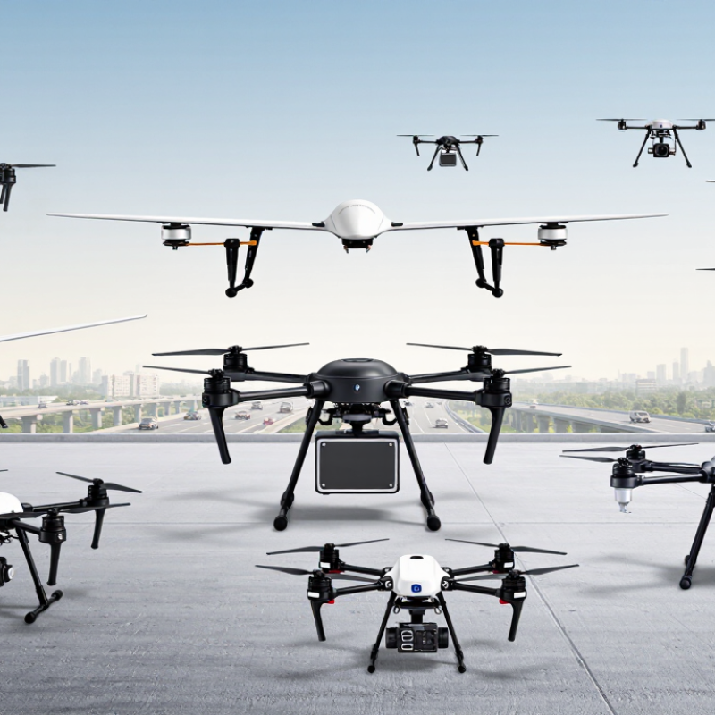
Air pollution detection drones measure contaminants with compact sensors carried beneath or inside the aircraft. Optical particle counters estimate airborne dust by measuring how particles scatter light. Electrochemical sensors can detect gases such as nitrogen dioxide or carbon monoxide. Each sensor responds differently, so readings are not direct, perfect measurements of every pollutant.
Before a flight, operators check calibration and record temperature and humidity, which can influence sensor response. During sampling, the drone logs readings alongside GPS position, altitude, and time. A grid pattern can reveal how concentrations change near a road or across an industrial perimeter. Short pauses at set heights help compare the air above rooftops with the air closer to street level. Small details matter.
Rotor wash can disturb nearby particles, especially when the drone hovers close to the ground. For more reliable data, teams may use an inlet positioned away from strong propeller airflow and compare results with a stationary reference instrument. Wind direction also matters: a plume may shift between passes. I would treat a single flight as a useful snapshot, not a complete picture. Sensor drift and uneven sampling can leave gaps, even when a map looks precise.
When comparing air pollution detection drones, start with the sensor payload, not the flight range. Check which pollutants it measures, such as fine particles, carbon monoxide, or nitrogen dioxide. A drone carrying several sensors may weigh more and stay airborne for less time. Small details matter. Look for a clearly described air inlet and sampling rate. Rotor wash can disturb readings, especially when the inlet sits too close to a propeller.
Calibration and data quality deserve equal attention. Ask how often sensors need calibration and whether the maker provides a method for checking readings against a trusted reference instrument. Review the stated detection limits, response time, and operating temperature range. These specifications affect whether the drone can capture brief pollution peaks or only broad trends. I would be cautious about treating one flight as proof of a lasting pollution pattern; wind and humidity can shift readings quickly.
Consider practical use, too. Compare real flight time with the payload attached, not just the empty-aircraft figure. GPS accuracy, timestamped logs, and exportable data make it easier to map readings to locations later. Check how the system handles wind, light rain, and battery changes in the field. A polished map is useful, but only if its measurements and collection conditions are recorded. No setup is perfect; sometimes a simpler sensor package gives more dependable results.
| Rank | Drone and Sensor Configuration | Pollutants It Can Measure | Typical Sensor Method | Indicative Payload Class | Practical Endurance With Payload | Best Suited For | Key Buying Consideration |
|---|---|---|---|---|---|---|---|
| 1 | Multirotor with particulate-matter payload | PM1, PM2.5 and PM10 (depending on the instrument) | Optical particle counting or light scattering | About 0.2–1.0 kg | About 20–40 minutes | Localized dust mapping, construction sites and plume surveys where hovering is useful | Check whether the inlet is designed to avoid rotor wash and whether humidity correction is available. Optical readings can be affected by particle composition and moisture. |
| 2 | Multirotor with electrochemical gas-sensor payload | Common options include CO, NO2, O3 and SO2; the exact gases depend on installed sensors | Electrochemical cells | About 0.2–1.0 kg | About 20–40 minutes | Short-range surveys around roads, industrial boundaries and suspected emission sources | Compare detection limits, cross-sensitivity, calibration intervals and response time for each gas. A sensor package does not necessarily measure every listed gas simultaneously. |
| 3 | Multirotor with non-dispersive infrared (NDIR) sensor | Carbon dioxide (CO2); some instruments also measure other infrared-active gases | Infrared absorption | About 0.2–1.2 kg | About 20–40 minutes | CO2 concentration mapping and investigations of concentrated exhaust or process plumes | Verify measurement range, accuracy, pressure and temperature compensation, and whether the instrument is suitable for fast-moving airborne sampling. |
| 4 | Multirotor with photoionization detector (PID) | Many volatile organic compounds (VOCs), reported as a total or equivalent concentration | Ultraviolet photoionization | About 0.2–0.8 kg | About 20–40 minutes | Rapid screening near solvent use, fuel handling and suspected VOC releases | A PID generally does not identify individual compounds. Check lamp energy, humidity response, calibration gas and correction-factor requirements. |
| 5 | Multirotor with ozone-specific payload | Ozone (O3) | Electrochemical sensing or ultraviolet absorption, depending on instrument | About 0.3–1.5 kg | About 18–40 minutes | Vertical ozone profiling and targeted outdoor measurements | Check whether the sensor is selective in the presence of other oxidizing gases, and confirm its response time and calibration procedure. |
| 6 | Multirotor with black-carbon or soot instrument | Black carbon or light-absorbing aerosol, depending on the instrument | Optical absorption or filter-based light attenuation | About 0.5–2.0 kg | About 15–35 minutes | Combustion-plume studies and aerosol research requiring more specialized measurements | These instruments can be heavier and more power-intensive than basic PM sensors. Compare time resolution, flow requirements and filter-maintenance needs. |
| 7 | Large multirotor with multi-gas sampling payload | Selected combinations of CO, CO2, NO2, O3, SO2 or VOC indicators | Combination of electrochemical, infrared and/or PID sensors | About 1–5 kg | About 12–30 minutes | Simultaneous measurement of several pollutants at a fixed point or along a short transect | Confirm the payload’s total weight, power draw, sensor cross-sensitivity and the effect of reduced flight time. More sensors do not automatically mean better data. |
| 8 | Fixed-wing drone with lightweight air-quality payload | Typically one or more lightweight PM or gas measurements, as supported by the payload | Depends on the selected particle or gas sensor | About 0.2–1.5 kg | About 60–180 minutes | Large-area surveys and repeated transects where long coverage matters more than hovering | Fixed-wing aircraft need space or a suitable system for launch and recovery, and they cannot hover. Endurance varies substantially with payload and flight conditions. |
| 9 | Hybrid VTOL fixed-wing drone with air-quality payload | Selected PM and/or gas measurements, depending on payload configuration | Depends on the installed sensor package | About 0.3–2.0 kg | About 45–150 minutes | Wide-area fieldwork where vertical takeoff is useful and longer routes are required | Compare payload capacity and endurance in fixed-wing cruise mode, not just advertised flight time. Check transition, landing and wind limitations. |
| 10 | Tethered multirotor with continuous monitoring payload | Commonly PM, CO2 or selected gases, depending on the installed sensors | Sensor-specific; data can be transmitted over the tether or a separate link | About 0.5–3.0 kg | Several hours may be possible while tethered; actual limits depend on the system and operating conditions | Long-duration monitoring at a fixed location, such as a worksite or temporary event | Check tether length, power delivery, wind limits, ground equipment and site permissions. A tether restricts the flight area and can create operational hazards. |
Comparison note: These are generic drone-and-sensor configurations, not specific commercial models. Payload and endurance figures are indicative ranges, not guaranteed specifications; actual performance depends on aircraft, battery, sensor package, weather and flight profile. Confirm sensor accuracy, calibration requirements, sampling design and local flight regulations before purchase. Drone-mounted readings are useful for targeted surveys but do not automatically replace regulatory reference monitoring.
Choosing among the top 10 air pollution detection drones starts with the sensor, not the airframe.
The World Health Organization’s 2022 Air Quality Database reports that 99% of people live where air quality exceeds its guideline levels. That makes reliable measurement important.
Compact quadcopters suit short surveys; endurance quadcopters cover larger sites. Hexacopters and octocopters can carry heavier payloads, while fixed-wing craft map broad areas efficiently. Hybrid vertical-takeoff models combine runway-free launches with longer flights. Tethered multirotors can monitor a fixed location, and microdrones fit selected indoor inspections. Heavy-lift and modular-payload platforms round out the ten options.
Fit matters.
Before buying, check whether the aircraft can carry calibrated sensors for the pollutants you need, such as particulate matter or nitrogen dioxide. Ask for documented accuracy, detection limits, sampling rates, and flight endurance with the actual payload installed. A published flight time without sensors can mislead.
Calibration matters. Wind, humidity, rotor wash, and sensor placement can all distort readings; compare drone measurements with a ground monitor when possible.
Look for geotagged data, usable exports, replaceable batteries, and safe, repeatable landing procedures.
A ten-item ranking is imperfect: the best choice for a street-level survey may be poor for a factory perimeter.
Test a small route before committing to a full fleet.
For a useful top-ten comparison, judge each aircraft by its complete sensing package, not its camera or airframe alone. A compact payload may log PM2.5, while broader kits add nitrogen dioxide, ozone, or carbon monoxide sensors. More channels mean extra weight, power draw, and calibration work. Watch the inlet, too: sensors placed near warm motors may sample biased air. Small detail. Check whether readings have been compared with a reference monitor. The U.S. EPA’s air-sensor guidance stresses evaluating sensor performance and data quality; raw readings should not be mistaken for regulatory measurements.
Flight-time figures need context. Compare endurance with the actual sensor, battery, and wind margin—not an empty-airframe claim. A practical test is a repeated route over a busy road, with reserve time to land safely. Data tools matter just as much. Look for synchronized timestamps, GPS-tagged readings, downloadable raw files, calibration records, and maps that show uncertainty. The WHO’s 2022 air-quality update reported that 99% of the global population breathed air exceeding its guideline limits. Reliable local measurements matter. Still, drone readings capture a moving sample, not a whole neighborhood. I would rank transparent data handling above a flashy dashboard, even if that makes the comparison less tidy.
Choosing an air-pollution drone starts with the pollutant you need to measure. A particulate sensor cannot replace a gas analyzer, and a broad sensor package may add weight without improving your results. Check payload capacity, flight time, sensor response speed, and whether readings can be geotagged. A hovering drone also samples a small patch of air, not an entire neighborhood.
The World Health Organization’s 2021 Global Air Quality Guidelines set annual and 24-hour PM2.5 guideline levels at 5 and 15 micrograms per cubic meter, respectively. Those thresholds are useful context, but a drone reading is not automatically comparable to a fixed monitoring station.
The U.S. Environmental Protection Agency’s Enhanced Air Sensor Guidebook advises evaluating sensors against reference instruments. Plan for calibration and repeat measurements. Small details matter.
Look closely at propeller airflow, too: it can disturb nearby particles or alter how a sensor inlet samples air. Consider whether the aircraft can carry a sheltered inlet and maintain a steady sampling speed. For roadside work, a short, repeatable route may be more useful than maximum range. Record humidity and temperature alongside pollutant readings, since conditions can affect sensor performance. Budget for replacement filters and post-flight data checks. I would still question any package promising precise results straight out of the box; field conditions are rarely that tidy.
Start with the sensor payload. Check which pollutants it measures, such as fine particles or nitrogen dioxide.
An inlet near a propeller may sample disturbed air. Small details matter. Check its position and airflow design.
Review detection limits, response time, and calibration needs. Ask how readings are checked against a trusted reference instrument.
Not completely. Wind and humidity can shift readings quickly, so one flight may not show a lasting pattern.
Compare real flight time with sensors and batteries attached. Allow reserve time for landing, especially on a repeated route.
Look for GPS-tagged readings, synchronized timestamps, downloadable raw files, and calibration records. A clear map helps, too.
Not necessarily. Extra sensors can add weight, use more power, and require more calibration. A simpler package may be steadier.
It should show where and when readings were collected, along with measurement uncertainty. A moving sample cannot represent an entire neighborhood.
Air Pollution Detection Drones provide a flexible way to monitor air quality across neighborhoods, industrial areas, and hard-to-reach locations. Equipped with suitable sensors, they can sample pollutants such as particulate matter and selected gases while recording where and when each reading was collected. Understanding how sensors work, their measurement range, and the limits of their accuracy helps users interpret results responsibly.
Before buying, compare sensor payload options, flight time, coverage, data storage, and software for viewing or exporting measurements. The top options differ in how easily they carry specialized equipment, maintain stable flights, and turn readings into useful reports. The right choice depends on the pollutants of interest, the size and conditions of the survey area, and the required level of detail. Matching these needs to a drone’s capabilities can support more consistent monitoring and clearer decisions.